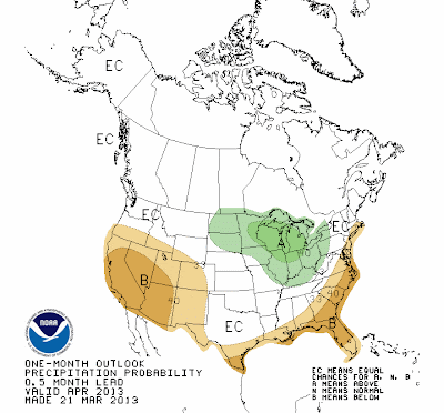
You'll notice that we still have plenty more in the way of winter weather to go the next week or two. For what it's worth, precipitation will be a little below normal, so hopefully that will mean not much more in the way of snow. The good news is that beyond early April, there are signs that some more spring-like weather will be rushing in. Longer range forecasts show the jet stream relaxing and heading north into Canada, which would finally allow the eastern half of the country to warm up more permanently. The question still is exactly when that will happen. A few days ago, it looked like next week would be the last week of cold before a more long term warm-up. As of today, it is looking more like a week and a half to two weeks of cold weather before things warm up around April 5th and beyond. Once we do warm things up though, indications are that we'll stay warm for quite some time with above normal temperatures expected through the rest of spring and into summer according to the CPC.
April temperature and precipitation outlooks from the CPC
April, May, and June precipitation outlooks from the CPC
Precipitation will stay near to slightly above normal from April - June according to CPC forecasts. Just wanted to throw a little ray of hope out there that spring will (eventually) be on it's way!


No comments:
Post a Comment